

SLAM laser scanning: measure in 3D before you design
Before you design or renovate, you need to know how the building or shed really is. With SLAM laser surveying we measure spaces quickly and accurately, and deliver plans, sections and 3D data ready for designers and site teams.
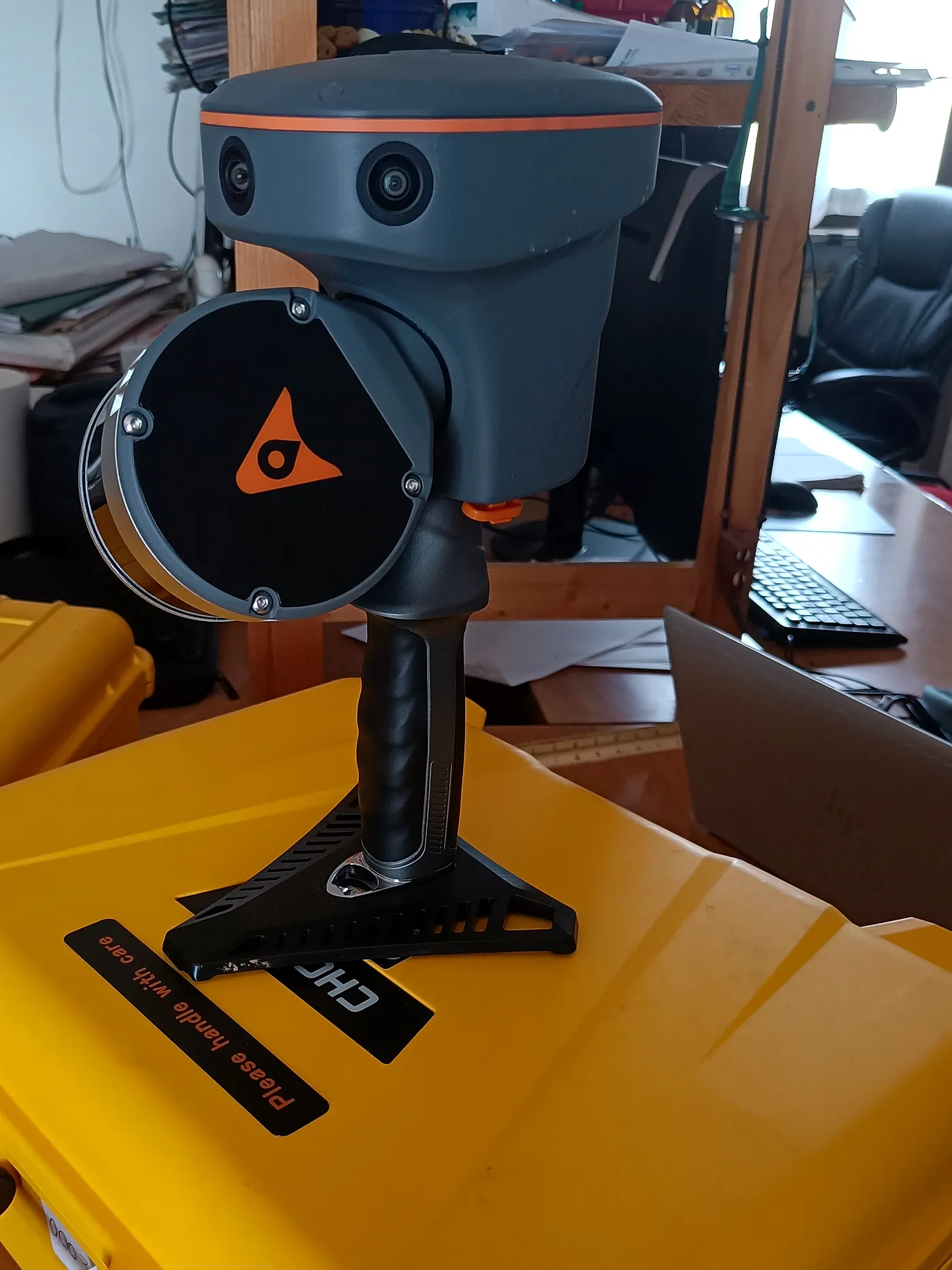
We use a handheld instrument (CHCNAV RS10) that works outdoors and indoors — even where GPS is weak — so one visit can document the whole site.
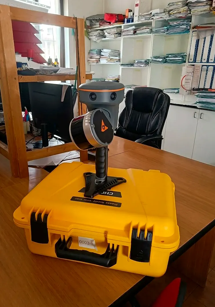
Equipment (CHCNAV RS10)
- GNSS RTK, LiDAR and visual SLAM on one platform: a single instrument from outdoors to indoors.
- Outdoor / indoor continuity and areas with weak satellite signal (SFix rover).
- Real-time SLAM: coverage checks on site before closing the survey.
- Up to about 320,000 points/s, 360° field of view, compact unit (~1.9 kg), IP64.
Frequently asked questions
How much does a SLAM laser survey cost?
Quotations vary by case (area, floors, access, travel and delivery formats). As a guide, for a flat of about 100 m² on a single floor, survey plus drawings and report is around €1,000. Tell us location and objective for a no-obligation proposal.
What accuracy can I expect?
In the manufacturer’s stated operating conditions, the RS10 platform indicates around 5 cm absolute accuracy combining RTK, laser and visual SLAM. Actual accuracy depends on environment, extent and objective: we define tolerances and checks in the quotation.
How long on site for a warehouse?
It depends on floor area, access and detail. On a logistics shed of about 8,000 m², one day of capture can cover the useful volume; processing and delivery follow the schedule agreed in the offer.
Can I receive only the point cloud?
Yes. We deliver georeferenced E57/LAS/LAZ as a stand-alone product. If the designer needs plans or a model, we add DWG/DXF or BIM support in the same commission.
Do you work only in the province of Brescia?
Franciacorta and the province of Brescia are our primary area. By appointment we also survey in Lombardy and Northern Italy — see the dedicated pages or give town and area in the contact form.
How does mobile SLAM compare with a static scanner?
Mobile SLAM (RS10) cuts time and setup on buildings, sheds and continuous indoor/outdoor paths. A static scanner remains preferable for millimetre detail on small fixed areas. In the brief we choose or combine methods to suit the objective.
Sectors and applications
SLAM surveying is built for design studios, contractors, facility teams and clients who need reliable geometry of existing conditions.
Buildings and renovations
Full surveys before design: plans, sections and levels from a dense cloud — fewer variations and misunderstandings on site.
Industry and logistics
Sheds, warehouses and plants: mobile capture over large floorplates, as-built documentation and clearance checks.
Plant rooms and technical spaces
MEP corridors, machine rooms, routes and clashes: complete geometry where traditional survey is slow or incomplete.
Heritage and historic property
Complex interiors and façades: continuous scanning with on-site coverage checks.
Integrated surveying
Links to GNSS RTK and total station so the 3D model aligns with design, cadastral and site coordinates.
Lombardy coverage
Office in Cazzago San Martino (BS), Franciacorta. Rapid response across the province of Brescia; by appointment in Lombardy and Northern Italy. See also the local landing pages.
- Franciacorta and province of Brescia
- Lombardy (by appointment)
- Northern Italy for structured briefs
What we deliver
| Format | Typical use |
|---|---|
| E57 / LAS / LAZ | Georeferenced point cloud for archive, checks and Scan-to-BIM. |
| DWG / DXF | Plans, sections and elevations for design and site. |
| BIM support | Point-cloud base and coordination for existing-condition models. |
| Field report | Coverage notes, tolerances and delivery checklist. |
How we work
Brief and access
We define objective, outputs and site constraints before mobilisation.
Mobile capture
SLAM paths indoor/outdoor with on-site coverage checks before closing the survey.
Processing
Registration, cleaning and georeferencing aligned to the agreed coordinate frame.
Delivery
E57/DWG/BIM and notes ready for design, facility or construction teams.
Projects
Examples of SLAM laser scanning and 3D documentation: mobile capture and working deliverables.
Go to projectsWhy mobile SLAM vs static scanning
| Topic | Mobile SLAM | Static scanner |
|---|---|---|
| Speed on large volumes | High — continuous paths | Lower — many stations |
| Indoor / outdoor continuity | Strong | Weaker without many setups |
| Millimetre detail on small areas | Good for as-built / design | Often preferred |
| Typical use | Buildings, sheds, plant rooms | Fine detail on fixed spots |
Quote for a SLAM survey in Lombardy
Share location, approximate area and required outputs (cloud, DWG, BIM): we reply with timing and a tailored quotation.